
0
Owner's of the Garmin GPS Receiver Garmin GPS Receiver gave it a score of 0 out of 5. Here's how the scores stacked up:


Appendix
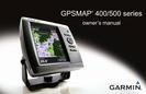
66 GPSMAP 400/500 Series Owner’s Manual
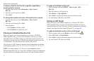
either been disconnected or the unit has lost communication with the sonar
device for some other reason.
—you entered a saved track name that
already exists in memory. Modify the track name or delete the existing track.
—the track log is full and track recording has been turned
off. To record more track points, you need to clear the track log and turn track
recording on. This only appears when the track recording setting is set to “Stop
When Full.”
—the track log memory is full.
No additional track log data can be stored without deleting old data to create
memory space.
—a complete uploaded track does not t into memory. The
oldest track log points were deleted to make space for the most recent data.
—there is not a transducer
attached, there is a bad cable or transducer, or the transducer cable was
disconnected. If the transducer cable is removed while the unit is on, reconnect
and cycle power.
—the unit has nished uploading or downloading
information to the connected device.
—attempted to transfer user data
without an SD card containing user data being present in the SD card slot.
—the auto-guidance route was calculated but the starting
and ending positions were moved because of safe depth settings.
—the speed sensor is not detected.
Check the connections.
—sonar has reported a temperature above, below,
inside, or outside the specied values.
—you entered a waypoint name that already exists
in memory. Modify the waypoint name or delete the existing waypoint.
—you have saved the maximum number of
waypoints. Delete unwanted waypoints to make space for new entries.
You can capture a screenshot of any screen displayed on your unit as a bitmap
(.BMP) le and then transfer it to your computer.
1. Insert an SD card into the SD card slot on the front of the unit.
2. Select > > .
3. Select to turn screenshot captures .
4. When you are on a screen you want to capture, press and hold the
button for at least six seconds.
5. Select when the Screenshot Taken window is displayed.
1. Remove the SD card from the chartplotter and insert it into an SD card
reader that is attached to a computer.
2. From Windows Explorer, open the Garmin\scrn folder on the SD card.


Find Your Products By Category
- Photography
- Video Game
- Computer Equipment
- TV and Video
- Communications
- Automotive
- Portable Media
- Marine Equipment
- Cell Phone
- Baby
- Home Audio
- Fitness & Sports
- Power Tools
- Household Appliance
- Car Audio and Video
- Personal Care
- Kitchen Appliance
- Lawn and Garden
- Musical Instruments & Equipment
- Laundry Appliance
- Outdoor Cooking
Please Login
