
0
Owner's of the Garmin GPS Receiver Garmin GPS Receiver gave it a score of 0 out of 5. Here's how the scores stacked up:
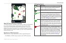
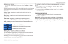

Conguring the Chartplotter
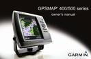
46 GPSMAP 400/500 Series Owner’s Manual
Use the Congure screen to congure unit settings.
To change general system settings from the Home screen, select
> .
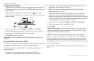
—turn Simulator mode on or off. Select to set simulator
options, such as simulated position, speed, and direction.
—select to set when the unit makes audible sounds.
Select > to brighten or darken the backlight. Select
> to switch between Day mode and Night mode (page 4).
—turn Auto Power or . When is selected, the
chartplotter will automatically turn on whenever power is applied, unless the
chartplotter is turned off with the Power Key before power is lost.
• —view GPS satellites.
• —view the GPS satellite constellation.
• —toggle WAAS (in North America) or EGNOS (in
Europe) on or off. WAAS/EGNOS can provide more-accurate GPS position
information. However, when using WAAS or EGNOS, the device takes
longer to acquire satellites.
• —select , , or . The speed lter averages the speed
of your boat over a short period of time for smoother speed values.
• —view system information and reset factory settings
(page 6). The > option is provided as a
troubleshooting tool. A Garmin Product Support representative may ask
you to use this feature to retrieve data about your chartplotter.
—displays a list of system events. Select an event to view additional
information.
To change units of measure from the Home screen, select >
> .
—a global setting that denes individual units of measure at
the same time: , , ,
or . Select to individually dene units of measure for depth,
temperature, distance, speed, elevation, volume, and pressure.
: You must be receiving NMEA sonar depth data or have a built-in
sonar with a temperature-capable transducer to view depth and water
temperature information.
—sets the reference used in calculating heading information.
• —automatically sets the magnetic declination for your
location.
• —sets true north as the heading reference.
• —sets grid north as the heading reference (000º).
• —allows you to set the magnetic variation value.
—change the coordinate style in which a given location
reading appears. Do not change the position format unless you are using a map
or chart that species a different position format.


Find Your Products By Category
- Photography
- Video Game
- Computer Equipment
- TV and Video
- Communications
- Automotive
- Portable Media
- Marine Equipment
- Cell Phone
- Baby
- Home Audio
- Fitness & Sports
- Power Tools
- Household Appliance
- Car Audio and Video
- Personal Care
- Kitchen Appliance
- Lawn and Garden
- Musical Instruments & Equipment
- Laundry Appliance
- Outdoor Cooking
Please Login
