
0
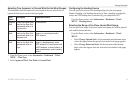
Owner's of the Garmin GPS Receiver Garmin GPS Receiver gave it a score of 0 out of 5. Here's how the scores stacked up:
Viewing Information
GPSMAP 400/500 Series Owner’s Manual 43
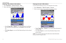
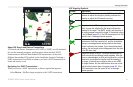
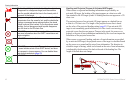
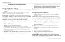
➊
Activated dangerous target
➋
Projected course
➌
MMSI
➍
Heading
➎
Direction of turn
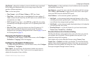
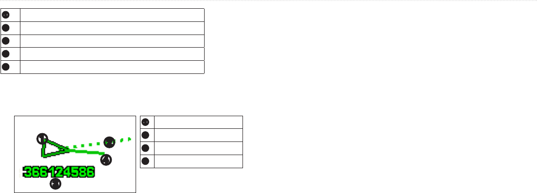
When course over ground and heading information are provided by an
activated AIS target, but rate-of-turn information is not provided, the projected
course of the target is calculated based on the course over ground information.
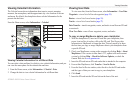
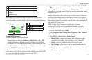
➊
Activated target
➋
Projected course
➌
MMSI
➍
Heading
➊
➍
➌
➋
AIS signal reception is turned on by default.
From the Home screen, select > > >.
All AIS functionality on all charts and on all 3D chart views is disabled.
This includes AIS vessel targeting and tracking, collision alarms that result
from AIS vessel targeting and tracking, and information about AIS vessels.
In order to avoid a large number of test alerts and symbols in crowded areas
such as marinas, AIS-SART test alerts ignored by default. To test an AIS SART
device, you must enable the chartplotter to receive test alerts.
From the Home screen, select > >
.
AIS requires the use of an external AIS device and active transponder signals
from other vessels.
You can congure how other vessels appear on a chart or on a 3D chart view.
The display range congured for one chart or one 3D chart view is applied
only to that chart or to that 3D chart view. The details, projected heading, and
trails settings congured for one chart or one 3D chart view are applied to all
charts and to all 3D chart views.
: Mariner’s Eye 3D charts are available only if you use a
BlueChart g2 Vision SD card. Fishing charts are available if you use a
BlueChart g2 Vision SD card or if your built-in map supports Fishing charts.
1. From the Home screen, select .
2. Select , , , or
.
3. Select > > .
• —indicates the distance from your location within
which AIS vessels appear. Select a distance or select .
• —shows or hides details about AIS-activated vessels.
• —allows you to enter the projected heading time for
AIS-activated vessels.
• —shows the tracks of AIS vessels. Select the length of the track
that appears using a trail.


Find Your Products By Category
- Photography
- Video Game
- Computer Equipment
- TV and Video
- Communications
- Automotive
- Portable Media
- Marine Equipment
- Cell Phone
- Baby
- Home Audio
- Fitness & Sports
- Power Tools
- Household Appliance
- Car Audio and Video
- Personal Care
- Kitchen Appliance
- Lawn and Garden
- Musical Instruments & Equipment
- Laundry Appliance
- Outdoor Cooking
Please Login
