

0
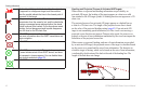
Owner's of the Garmin GPS Receiver Garmin GPS Receiver gave it a score of 0 out of 5. Here's how the scores stacked up:

Viewing Information
42 GPSMAP 400/500 Series Owner’s Manual
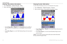
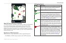
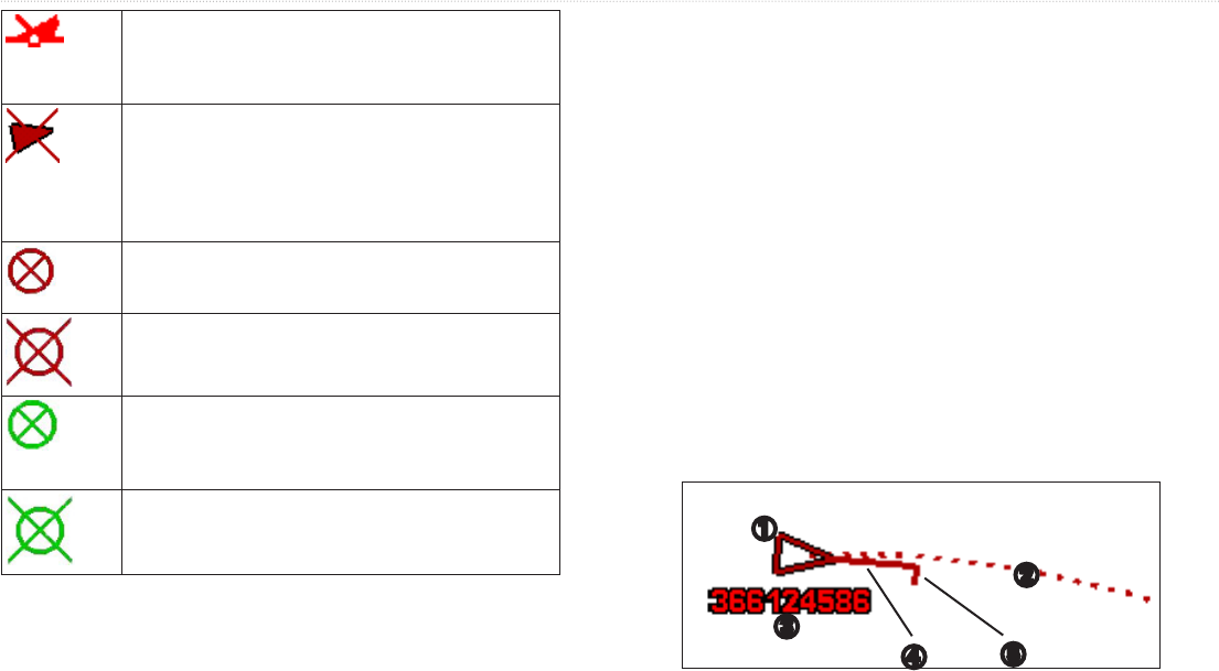
The location of this symbol indicates the closest point
of approach to a dangerous target, and the numbers
near the symbol indicate the time to the closest point of
approach to that target�
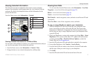
Dangerous target is lost� A red indicates that the AIS
transmission from the vessel is lost, and the chartplotter
displays a message banner asking whether the vessel
should continue to be tracked� If you discontinue vessel
tracking, the lost dangerous target symbol disappears
from the chart or the 3D chart view�
AIS-SART transmission� You can select this symbol to
see more information about the SART transmission and
begin navigation�
AIS-SART transmission lost�
AIS-SART transmission test� This symbol appears when
a vessel initiates a test of their SART device, and does
not represent a true emergency� You can disable these
test symbols and alerts (page 43)
AIS-SART transmission test lost�
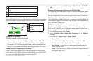
When course over ground and heading information are provided by an
activated AIS target, the heading of the target appears on a chart as a solid
line attached to the AIS target symbol. A heading line does not appear on a 3D
chart view.
The projected course of an activated AIS target appears as a dashed line on
a chart or a 3D chart view. The length of the projected course line is based
on the value of the projected heading setting (page 43). If an activated AIS
target is not transmitting speed information, or if the vessel is not moving, a
projected course line does not appear. Changes in the speed, the course over
ground, or the rate-of-turn information transmitted by the vessel can impact the
calculation of the projected course line.
When course over ground, heading, and rate-of-turn information are provided
by an activated AIS target, the projected course of the target is calculated based
on the course over ground and the rate-of-turn information. The direction in
which the target is turning, which is also based on the rate-of-turn information,
is indicated by the direction of the barb at the end of the heading line. The
length of the barb does not change.
➊
➎
➍
➌
➋


Find Your Products By Category
- Photography
- Video Game
- Computer Equipment
- TV and Video
- Communications
- Automotive
- Portable Media
- Marine Equipment
- Cell Phone
- Baby
- Home Audio
- Fitness & Sports
- Power Tools
- Household Appliance
- Car Audio and Video
- Personal Care
- Kitchen Appliance
- Lawn and Garden
- Musical Instruments & Equipment
- Laundry Appliance
- Outdoor Cooking
Please Login
