
0
Owner's of the Garmin GPS Receiver Garmin GPS Receiver gave it a score of 0 out of 5. Here's how the scores stacked up:
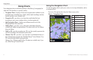
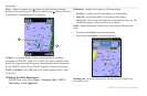
Using Charts
8 GPSMAP 400/500 Series Owner’s Manual
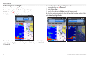
Your chartplotter has a worldwide basemap or BlueChart g2 cartography for
either the USA shoreline or a specic country.
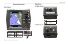
• —displays all relevant navigation data available on your
preloaded maps, including buoys, lights, cables, depth soundings, marinas,
and tide stations, in an overhead view.
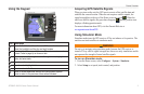
• —provides a view from above and behind the boat
(according to your course), and provides a visual navigation aid.
• —displays two different zoom levels of the
Navigation chart at the same time.
• —provides a view of the chart with enhanced bottom
contours and without navigational data. This chart works well for offshore
deep-sea shing.
• —provides an underwater 3D view that visually represents the
sea oor according to the information on the chart.
• —provides a view from above and behind the boat as a
three-dimensional navigation aid. The BlueChart g2 Vision Mariner’s Eye
3D is more detailed than the preloaded data.
Mariner’s Eye 3D charts and Fish Eye 3D charts are available only if you
use a BlueChart g2 Vision SD card.
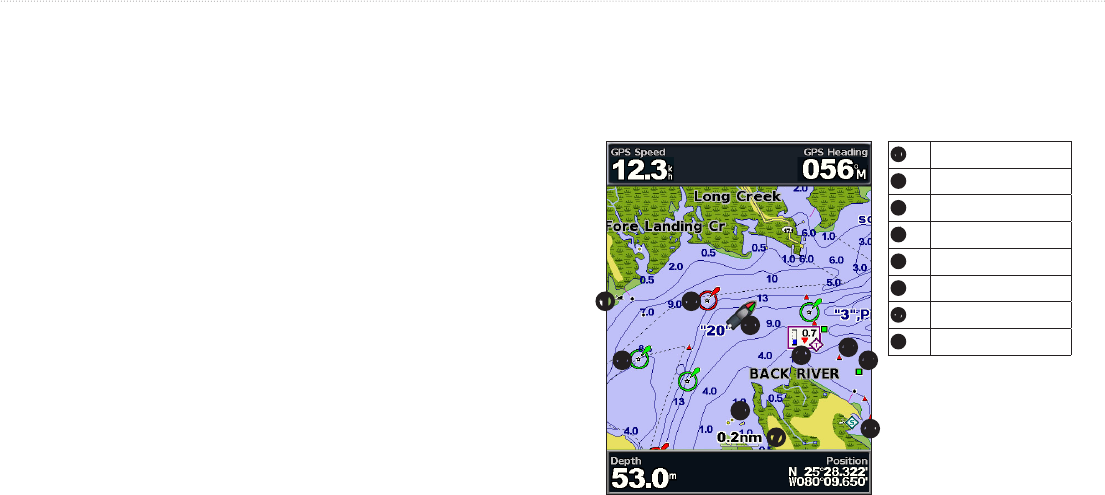
Use the Navigation chart to plan your course, to view map information, and as
a navigational aid.
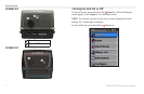
To access a Navigation chart, from the Home screen, select
> .
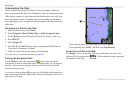
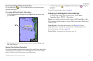
➊
Exposed Wreck
➋
Light
➌
Your boat
➍
Tide station
➎
Beacon
➏
Exposed rock
➐
Zoom scale
➑
Marina services
➊
➑
➐
➏
➎
➍
➌
➋
➋
➎


Find Your Products By Category
- Photography
- Video Game
- Computer Equipment
- TV and Video
- Communications
- Automotive
- Portable Media
- Marine Equipment
- Cell Phone
- Baby
- Home Audio
- Fitness & Sports
- Power Tools
- Household Appliance
- Car Audio and Video
- Personal Care
- Kitchen Appliance
- Lawn and Garden
- Musical Instruments & Equipment
- Laundry Appliance
- Outdoor Cooking
Please Login
