

0
Owner's of the Bushnell GPS Receiver Onix gave it a score of 0 out of 5. Here's how the scores stacked up:
11
Note: Your XM Weather subscription must be activated, and XM reception
turned on, before it is possible to display any weather information.
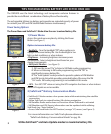
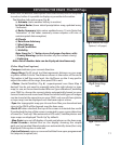
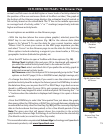
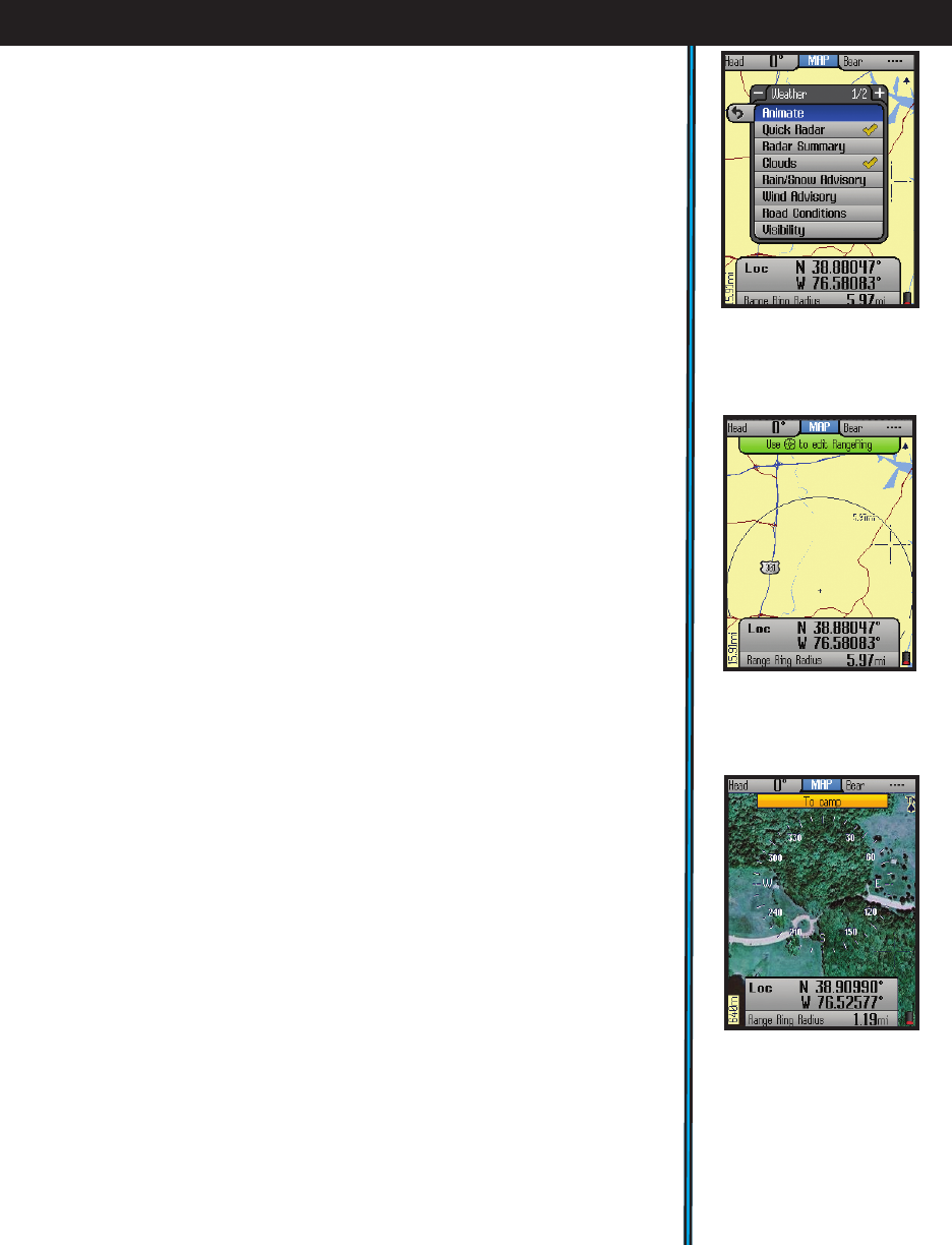
The Weather Info options are (Fig. 4):
a) Animate (view weather history in motion)
b) Quick Radar (lower detail precipitation map, updated every
2 minutes)
c) Radar Summary (data series updated every 15 min. Note that
“animation” of the radar summary screen requires ≥30 min. of
uninterrupted data reception)
d) Clouds
e) Rain/Snow Advisory
f) Wind Advisory
g) Road Conditions
h) Visibility
Note-Press the “+” button to see 2nd page of options, with:
i) County Warnings (within borders of your current county)
j) Lightning
Note: not all weather data can be displayed simultaneously
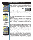
(Other Map Detail options)
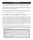
•Compass-indicates your current direction.
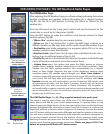
•Range Rings (Fig. 5)-visual tool that represents distance on your map
or photo within a circle. The distance shown is the radius of the circle.
This radius is half the zoom level. Use Up/Down on the 5-way pad to
adjust the radius of the rings, then press OK to exit.
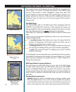
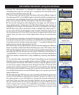
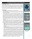
• Photos (Aerial/Satellite) (Fig. 6) -superimposed over Base Map if
desired. You do not need to manually select the right photo (or topo
map) to use, as these downloaded files are “geo referenced”, enabling
your ONIX to choose the correct photo automatically, based on your
current location and zoom level. Note that while both types of images
can be stored at the same time on your ONIX, only one of them (photo
or topo map) can be displayed over the base map at a time.
•Topo-the topographic map you choose from files you download and
store in the ONIX will be layered over the base map
•North UP-when checked, the top of the screen is oriented due north.
If unchecked, the top of the screen is oriented to your current direction
of travel (i.e.“track up”-like automotive GPS units). Satellite photos and
topo maps are displayed “North Up” by default.
• Map Data-turns on/off display of roads and places on the base map
•Bread Crumbs-a dotted line on the display showing the simple
path you’ve traveled. Breadcrumbs are automatically stored, but only
displayed if this option is selected.
•Points of Interest-major or common facilities from a pre-programmed
list (airports, hospitals, etc)
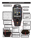
EXPLORING THE PAGES : The MAP Page
Fig 4.
Weather Info Layer
Options (1 of 2 pages)
Fig 5.
Range Rings
Layer
Fig 6.
Satellite Photo
Layer


Find Your Products By Category
- Photography
- Video Game
- Computer Equipment
- TV and Video
- Communications
- Automotive
- Portable Media
- Marine Equipment
- Cell Phone
- Baby
- Home Audio
- Fitness & Sports
- Power Tools
- Household Appliance
- Car Audio and Video
- Personal Care
- Kitchen Appliance
- Lawn and Garden
- Musical Instruments & Equipment
- Laundry Appliance
- Outdoor Cooking
Please Login
